2011
NM2742 : Path on Lunga
taken 13 years ago, near to Sgeir a' Chaisteil [other Features], Argyll And Bute, Great Britain
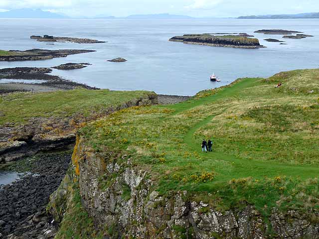
Path on Lunga
The largest island nearby is Sgeir an Eironnaich NM2843. On the horizon, from left to right, can be seen the Isles of Rum, Skye (far distance) Muck, Eigg and Mull.
 Map © Crown Copyright")
TIP: Click the map for more Large scale mapping
- Grid Square
- NM2742, 54 images (more nearby 🔍)
- Photographer
- Oliver Dixon (more nearby)
- Date Taken
- Wednesday, 31 August, 2011 (more nearby)
- Submitted
- Monday, 5 September, 2011
- Subject Location
-
OSGB36:
 NM 2797 4232 [10m precision]
WGS84: 56:29.6460N 6:25.2855W - Camera Location
-
OSGB36: NM 27930 42244
- View Direction
- North-northeast (about 22 degrees)