2011
NR2564 : Benchmark on Rockmountain
taken 13 years ago, near to Carnduncan, Islay, Argyll And Bute, Scotland
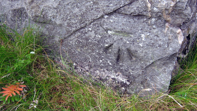
Benchmark on Rockmountain
Ordnance Survey cut mark benchmark described on the Bench Mark Database at Link
 Map © Crown Copyright")
TIP: Click the map for more Large scale mapping
- Grid Square
- NR2564, 17 images (more nearby 🔍)
- Photographer
- Roger Templeman (more nearby)
- Date Taken
- Tuesday, 30 August, 2011 (more nearby)
- Submitted
- Monday, 5 September, 2011
- Subject Location
-
OSGB36:
 NR 2533 6464 [10m precision]
WGS84: 55:47.8041N 6:23.0450W - Camera Location
-
OSGB36: NR 2533 6464
- View Direction
- NORTH (about 0 degrees)