2011
SP2280 : Mercote Mill Farm
taken 13 years ago, near to Four Oaks, Solihull, England
This is 1 of 2 images, with title Mercote Mill Farm in this square
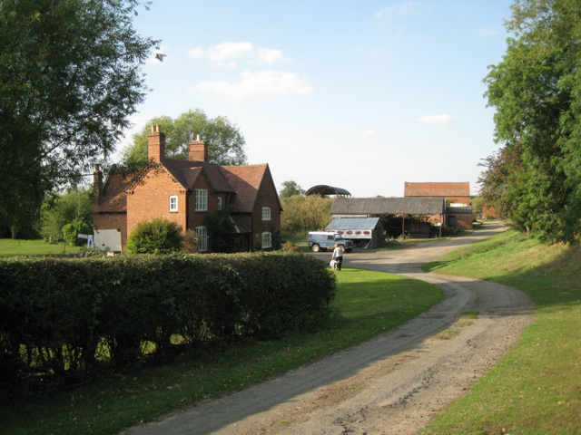
Mercote Mill Farm
The mill was apparently somewhere on the right; it was demolished by the Berkswell estate. The farm buildings occupy an island, as it were, in a sea of sand and gravel workings. Maps show the track to the farm as a public footpath to Cornets End although it has been diverted: see SP2280 : Bund near the site of Mercote Hall
Photographed with permission.
Photographed with permission.
 Map © Crown Copyright")
TIP: Click the map for more Large scale mapping
- Grid Square
- SP2280, 34 images (more nearby 🔍)
- Photographer
- Robin Stott (more nearby)
- Date Taken
- Thursday, 1 September, 2011 (more nearby)
- Submitted
- Monday, 5 September, 2011
- Subject Location
-
OSGB36:
 SP 2264 8061 [10m precision]
WGS84: 52:25.3809N 1:40.1101W - Camera Location
-
OSGB36: SP 2263 8055
- View Direction
- NORTH (about 0 degrees)