2011
NT7559 : The track to Windshiel
taken 13 years ago, 3 km from Ellemford, Scottish Borders, Scotland
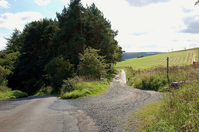
The track to Windshiel
The road continues down to meet the B6355 at Burnhouses, while the track slants past Oatleycleugh to Windshiel to meet the road there. The track is also signposted as a footpath.
 Map © Crown Copyright")
TIP: Click the map for more Large scale mapping
- Grid Square
- NT7559, 14 images (more nearby 🔍)
- Photographer
- Jim Barton (more nearby)
- Date Taken
- Sunday, 4 September, 2011 (more nearby)
- Submitted
- Tuesday, 6 September, 2011
- Subject Location
-
OSGB36:
 NT 7539 5915 [10m precision]
WGS84: 55:49.4978N 2:23.6629W - Camera Location
-
OSGB36: NT 7540 5919
- View Direction
- SOUTH (about 180 degrees)