SP6736 : Stowe Park, Octagon Lake
taken 13 years ago, near to Chackmore, Buckinghamshire, England
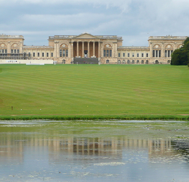
Stowe house and gardens were all about prestige and making a statement. As the Stowe guide book describes it, power gardening. They were enlarged and developed in three phases by Richard, Viscount Cobham and his nephew Richard, Earl Temple from about 1700 to 1760.
Significant practitioners in the development included the architects Sir John Vanbrugh and James Gibbs, and the gardeners Charles Bridgeman and William Kent. Lancelot Capability Brown was head gardener here from 1741 to 1751, which made his reputation. In the 18th and 19th centuries the house and gardens were internationally known and renowned and were some of the first gardens that people visited as tourists for their own pleasure.
By the 20th century the family had become bankrupt and in 1921 sold the estate to become Stowe School, Englands newest public school. Today the gardens are maintained by the National Trust and are open to the public. The house is owned by a Preservation Trust, under the auspices of the English Historic Houses Association, used by Stowe School and open to the public at restricted times throughout the year.
Written by Graham Horn
 Map © Crown Copyright")
- Grid Square
- SP6736, 100 images (more nearby 🔍)
- Photographer
- Graham Horn (more nearby)
- Date Taken
- Sunday, 28 August, 2011 (more nearby)
- Submitted
- Tuesday, 6 September, 2011
- Subject Location
-
OSGB36:
 SP 6772 3696 [10m precision]
WGS84: 52:1.6158N 1:0.8635W - Camera Location
-
OSGB36: SP 6775 3689
- View Direction
- North-northwest (about 337 degrees)