2011
SO8927 : The A38 near Coombe Hill
taken 13 years ago, near to Coombe Hill, Gloucestershire, England
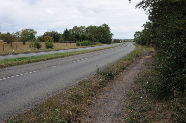
The A38 near Coombe Hill
In the 1960s much of the A38 between Tewkesbury and Coombe Hill was upgraded to a dual carriageway, this was in the days before the M5 motorway continued south of junction 8 at Strensham, meaning southbound motorway traffic would be directed down this road. In recent years traffic calming measures have reduced this road back one lane north and south apart from this southern section nearest to Coombe Hill which has remained a dual carriageway.
 Map © Crown Copyright")
TIP: Click the map for more Large scale mapping
- Grid Square
- SO8927, 9 images (more nearby 🔍)
- Photographer
- Philip Halling (more nearby)
- Date Taken
- Saturday, 13 August, 2011 (more nearby)
- Submitted
- Tuesday, 6 September, 2011
- Subject Location
-
OSGB36:
 SO 8918 2798 [10m precision]
WGS84: 51:57.0123N 2:9.5304W - Camera Location
-
OSGB36: SO 8919 2794
- View Direction
- North-northwest (about 337 degrees)