TQ2013 : Downs Link bridge over the River Adur
taken 13 years ago, near to Small Dole, West Sussex, England
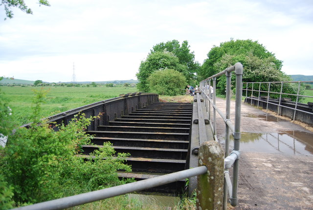
The Downs Link is a 37-mile (59 km) footpath and bridleway linking the North Downs Way Link at St. Martha's Hill in Surrey with the South Downs Way Link near Steyning in West Sussex and on via the Coastal Link to Shoreham-by-Sea. Most of the route follows two dismantled railway lines, both closed by the Beeching cuts in the 1960s. The Shoreham-On-Sea to Christs Hospital line and the Christs Hospital to Shalford Junction line. The link opened in 1984.
Cycle Route 223 follows the Downs link from Guildford to Shoreham.
The logo for the walk is the viaduct across the River Arun TQ0932 : Double Viaduct over the River Arun.
A full history of the Cranleigh line (Christs Hospital to Shalford Junction) can be read at Link
The river was formerly navigable for large vessels up as far as Steyning, where there was a large port, but over time the river valley became silted up and the port moved down to the deeper waters nearer the mouth in Shoreham-by-Sea. Link
 Map © Crown Copyright")
- Grid Square
- TQ2013, 75 images (more nearby 🔍)
- Photographer
- N Chadwick (more nearby)
- Date Taken
- Sunday, 8 May, 2011 (more nearby)
- Submitted
- Friday, 9 September, 2011
- Subject Location
-
OSGB36:
 TQ 2000 1364 [10m precision]
WGS84: 50:54.5859N 0:17.6722W - Camera Location
-
OSGB36: TQ 2000 1366
- View Direction
- South-southwest (about 202 degrees)