2011
SP2581 : Church Farm and St Lawrence's Church
taken 13 years ago, near to Four Oaks, Solihull, England
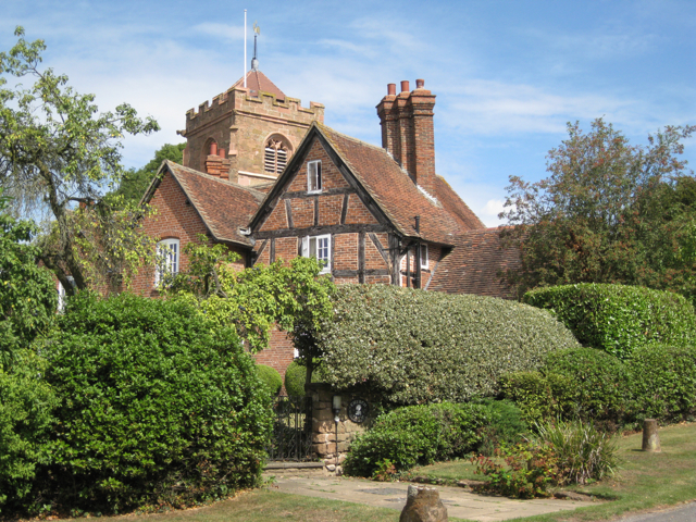
Church Farm and St Lawrence's Church
Strategically sited on a small hill, the church marks the original village (known as Alspath) which moved to the main road (the present Old Road) to provide inns and alehouses for passengers. Church Farmhouse dates from 1610, much rebuilt in the 19th century; listed Grade II. The sandstone church has a Norman chancel and features of all periods: listed Grade I. The view is from the southern part of Church Lane. The other side of the building is seen in SP2581 : Church Farmhouse, Meriden.
 Map © Crown Copyright")
TIP: Click the map for more Large scale mapping
- Grid Square
- SP2581, 34 images (more nearby 🔍)
- Photographer
- Robin Stott (more nearby)
- Date Taken
- Friday, 19 August, 2011 (more nearby)
- Submitted
- Friday, 9 September, 2011
- Subject Location
-
OSGB36:
 SP 2520 8163 [10m precision]
WGS84: 52:25.9243N 1:37.8469W - Camera Location
-
OSGB36: SP 2518 8161
- View Direction
- Northeast (about 45 degrees)