2011
TQ7825 : Bodiam Bridge & River Rother
taken 13 years ago, near to Bodiam, East Sussex, England
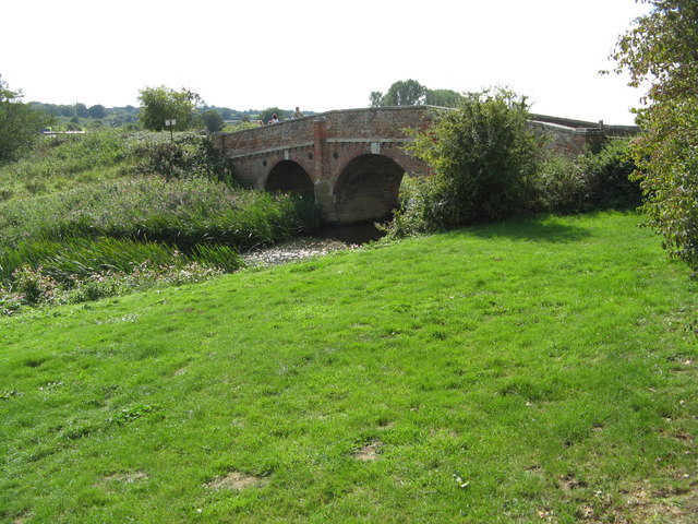
Bodiam Bridge & River Rother
The Rother and climate change.
Where you are standing now (position I took the photo) will almost certainly be under water in 50 years' time as a result of climate change. A foretaste of this was given in November 2000 when the river burst its banks and flooded the area. See TQ7825 : River Rother and Climate Change Notice
Where you are standing now (position I took the photo) will almost certainly be under water in 50 years' time as a result of climate change. A foretaste of this was given in November 2000 when the river burst its banks and flooded the area. See TQ7825 : River Rother and Climate Change Notice
 Map © Crown Copyright")
TIP: Click the map for more Large scale mapping
- Grid Square
- TQ7825, 624 images (more nearby 🔍)
- Photographer
- Josie Campbell (more nearby)
- Date Taken
- Saturday, 10 September, 2011 (more nearby)
- Submitted
- Saturday, 10 September, 2011
- Subject Location
-
OSGB36:
 TQ 7834 2533 [10m precision]
WGS84: 50:59.9834N 0:32.4159E - Camera Location
-
OSGB36: TQ 7836 2534
- View Direction
- West-southwest (about 247 degrees)