1986
NO0583 : Summit of Carn Bhac
taken 37 years ago, near to Carn Creagach [hill or Mountain], Aberdeenshire, Great Britain
This is 1 of 3 images, with title Summit of Carn Bhac in this square
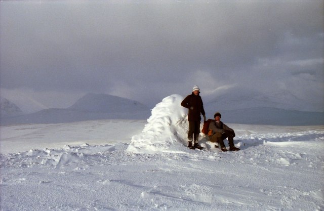
Summit of Carn Bhac
On extreme left is The Devil's Point with Carn a' Mhaim across the Lairig Ghru from it and Sgor Mor between and in front of them.
 Map © Crown Copyright")
TIP: Click the map for more Large scale mapping
- Grid Square
- NO0583, 18 images (more nearby 🔍)
- Photographer
- Russel Wills (more nearby)
- Date Taken
- Monday, 22 December, 1986 (more nearby)
- Submitted
- Sunday, 11 September, 2011
- Subject Location
-
OSGB36:
 NO 0511 8321 [10m precision]
WGS84: 56:55.8253N 3:33.6467W - Camera Location
-
OSGB36: NO 0514 8314
- View Direction
- North-northwest (about 337 degrees)