2011
SJ9422 : The Sow/Penk floodplain near Baswich, Stafford
taken 13 years ago, near to Weeping Cross, Staffordshire, England
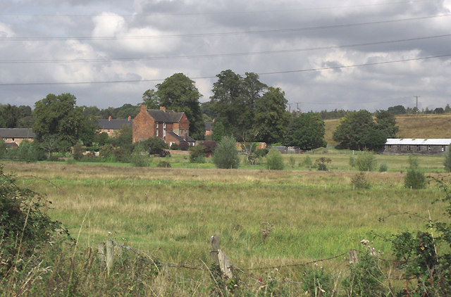
The Sow/Penk floodplain near Baswich, Stafford
The rough land by the rivers is often waterlogged or flooded, so is only occasionally used for grazing. The red-brick farmhouse is on Thomas Priory Farm. It is to the left of that where the River Penk joins the River Sow, and some interesting embankments divert Kingston Brook's course to the Sow. A look at the satellite images is worthwhile.
 Map © Crown Copyright")
TIP: Click the map for more Large scale mapping
- Grid Square
- SJ9422, 267 images (more nearby 🔍)
- Photographer
- Roger D Kidd (more nearby)
- Date Taken
- Sunday, 4 September, 2011 (more nearby)
- Submitted
- Wednesday, 14 September, 2011
- Subject Location
-
OSGB36:
 SJ 949 227 [100m precision]
WGS84: 52:48.1218N 2:4.5478W - Camera Location
-
OSGB36: SJ 949 225
- View Direction
- NORTH (about 0 degrees)