2011
NM8028 : Barnabuck Farm
taken 13 years ago, 3 km from Balliemore, Kerrera, Argyll And Bute, Scotland
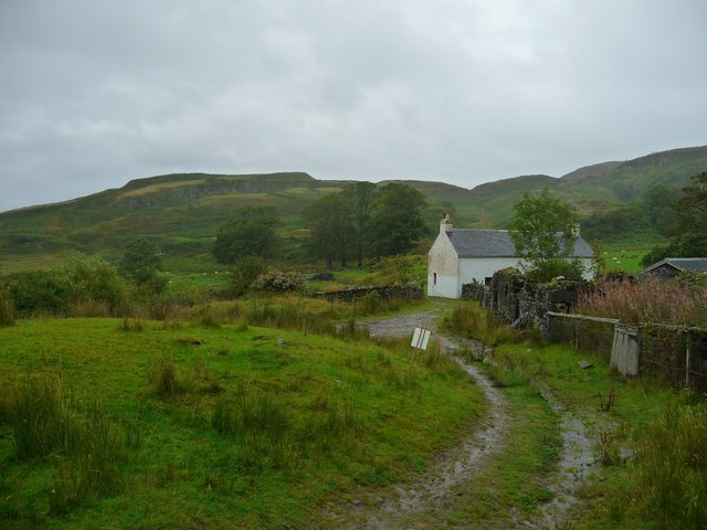
Barnabuck Farm
This is one of the few occupied buildings and working farms on Kerrera.The population was 39 in the 1991 census whilst it was 187 in 1841. However, there is a most welcome cafe at Upper Gylen (NM801268) open from Wednesday to Sunday which also offers bunkhouse accommodation.
 Map © Crown Copyright")
TIP: Click the map for more Large scale mapping
- Grid Square
- NM8028, 23 images (more nearby 🔍)
- Photographer
- ronnie leask (more nearby)
- Date Taken
- Saturday, 10 September, 2011 (more nearby)
- Submitted
- Saturday, 17 September, 2011
- Subject Location
-
OSGB36:
 NM 8017 2833 [10m precision]
WGS84: 56:23.7558N 5:33.8166W - Camera Location
-
OSGB36: NM 7995 2831
- View Direction
- EAST (about 90 degrees)