2011
TL3669 : Mare Fen
taken 13 years ago, near to Over, Cambridgeshire, England
This is 1 of 8 images, with title Mare Fen in this square
Mare Fen
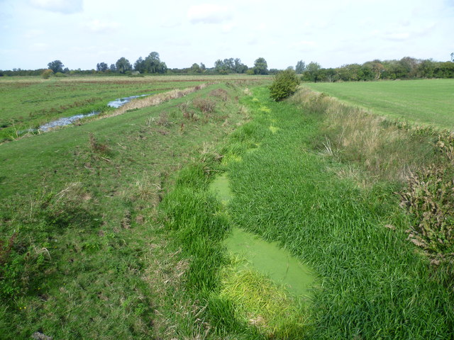
Mare Fen is a large expanse of permanent pasture in the floodplain of the River Great Ouse. It is used for summer grazing. Grassland like this was once common in the Great Ouse Valley, but the reserve is now one of the remaining fragments. As it is flooded in winter, the reserve is excellent for birds, providing much needed shallow water for over-wintering waterfowl and wading birds. Mare Fen is managed as a nature reserve by the Wildlife Trust for Bedfordshire, Cambridgeshire, Northamptonshire and Peterborough. This rather overgrown dyke, seen from Over Road, heads towards the River Great Ouse in the distance.
 Map © Crown Copyright")
TIP: Click the map for more Large scale mapping
- Grid Square
- TL3669, 213 images (more nearby 🔍)
- Photographer
- Marathon (more nearby)
- Date Taken
- Thursday, 22 September, 2011 (more nearby)
- Submitted
- Thursday, 29 September, 2011
- Subject Location
-
OSGB36:
 TL 3662 6986 [10m precision]
WGS84: 52:18.5918N 0:0.1540E - Camera Location
-
OSGB36: TL 3665 6980
- View Direction
- North-northwest (about 337 degrees)