2011
NZ3528 : East Well House, Sedgefield
taken 13 years ago, near to Sedgefield, County Durham, England
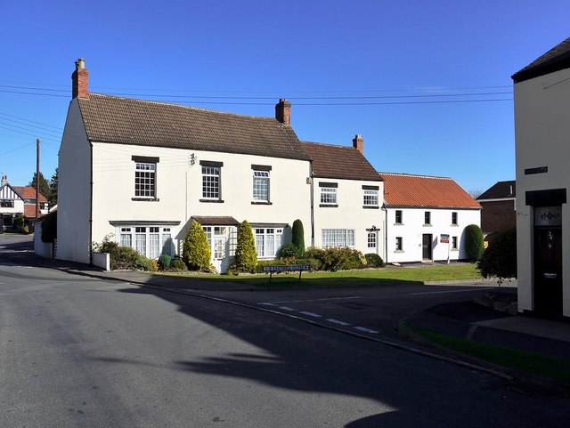
East Well House, Sedgefield
This was built as an C18th farmhouse which were built outside the town after the enclosure of common land in 1636. The original Sedgefield workhouse used to stand next to the farm, but was demolished in the mid C19th.
Link
Link
Sedgefield Heritage Trail
On a good day, the town looks very pretty and has much of interest. A good place to start is the Heritage Trail which is available on the web Link
 Map © Crown Copyright")
TIP: Click the map for more Large scale mapping
- Grid Square
- NZ3528, 120 images (more nearby 🔍)
- Photographer
- Andrew Curtis (more nearby)
- Date Taken
- Friday, 7 October, 2011 (more nearby)
- Submitted
- Saturday, 8 October, 2011
- Subject Location
-
OSGB36:
 NZ 3586 2899 [10m precision]
WGS84: 54:39.2842N 1:26.7423W - Camera Location
-
OSGB36: NZ 3585 2897
- View Direction
- North-northeast (about 22 degrees)