TL1201 : The Building Research Station (3)
taken 27 years ago, near to Bricket Wood, Hertfordshire, England
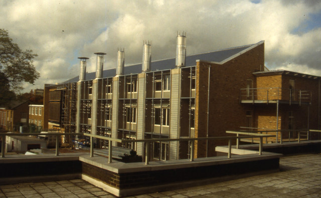
(Photo taken from the first-floor exterior gallery of building 18.)
The Building Research Station (BRS) was formed at East Acton in 1921. It moved in 1925 to this site at Garston where it had space to expand. Part of the site was used as a back-up to Bentley Priory RAF fighter control during WW2; 80 Wing, the RAF radio-countermeasures department, was also housed here briefly before moving to nearby Radlett. Most of the site buildings are post-war developments.
In 1972 BRS was merged with the Forest Products Laboratory at Princes Risborough and the Fire Research Station at Borehamwood (see TQ1995 and TQ1996) to form the Building Research Establishment (BRE). By 1994 both the FRS and Princes Risborough sites had been cleared by staff moving to the BRE site. In 1997 BRE was sold off to the management to form BRE Ltd., a not-for-profit company.
Information on current BRE Ltd. activities can be found at Link.
 Map © Crown Copyright")
- Grid Square
- TL1201, 20 images (more nearby 🔍)
- Photographer
- John Webb (more nearby)
- Date Taken
- 1997 (more nearby)
- Submitted
- Saturday, 8 October, 2011
- Subject Location
-
OSGB36:
 TL 1251 0142 [10m precision]
WGS84: 51:42.0154N 0:22.4021W - Camera Location
-
OSGB36: TL 1254 0141
- View Direction
- West-northwest (about 292 degrees)