2011
HP5604 : Lund: burial ground extension at St. Olafs church
taken 13 years ago, near to Lund, Unst, Shetland Islands, Scotland
Lund: burial ground extension at St. Olafs church
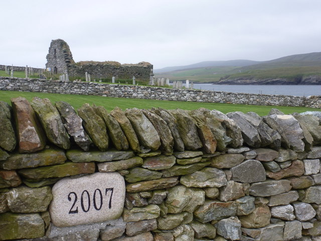
Looking across the outer wall of the churchyard at HP5604 : Lund: St. Olafs church which was extended in 2007 to allow further interments to take place. Between this and the original wall, the ground has been marked out in the rows which will eventually be filled, but there have been only a few burials since the new ground opened.
 Map © Crown Copyright")
TIP: Click the map for more Large scale mapping
- Grid Square
- HP5604, 107 images (more nearby 🔍)
- Photographer
- Chris Downer (more nearby)
- Date Taken
- Monday, 1 August, 2011 (more nearby)
- Submitted
- Monday, 17 October, 2011
- Subject Location
-
OSGB36:
 HP 5668 0405 [10m precision]
WGS84: 60:42.9341N 0:57.7892W - Camera Location
-
OSGB36: HP 5667 0403
- View Direction
- North-northeast (about 22 degrees)