2011
J3975 : The Belmont Road, Belfast (7)
taken 13 years ago, 3 km from Dundonald, Co Down, Northern Ireland
The Belmont Road, Belfast (7)
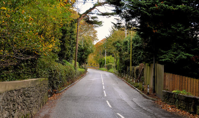
The Belmont Road, crossing a stream, just before the start of Craigantlet hill. This remains the limit of development and was previously the city boundary (this post J3975 : Boundary post, east Belfast (4) is in the bottom right-hand corner). The present boundary between Belfast and North Down is a short distance further up the hill J4075 : Craigantlet hill near Belfast (1).
The Belmont Road, Belfast
The Belmont Road runs from the Holywood Road, at Gelstons Corner, through suburban east Belfast, to Craigantlet hill just outside the built-up area.
Loading map... (JavaScript required)
- Grid Square
- J3975, 81 images (more nearby 🔍)
- Photographer
- Albert Bridge (more nearby)
- Date Taken
- Wednesday, 19 October, 2011 (more nearby)
- Submitted
- Wednesday, 19 October, 2011
- Subject Location
-
Irish:
 J 395 752 [100m precision]
WGS84: 54:36.3771N 5:50.4835W - Camera Location
-
Irish: J 394 753
- View Direction
- Southeast (about 135 degrees)