2011
NO8785 : Fish Quay and Shorehead, Stonehaven
taken 12 years ago, near to Stonehaven, Aberdeenshire, Scotland
This is 1 of 2 images, with title starting with Fish Quay in this square
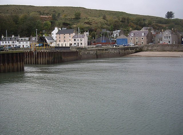
Fish Quay and Shorehead, Stonehaven
Viewed across the outer harbour. The red/white strip above the houses is where a landslip has been causing problems in recent times for both residents and road traffic.
 Map © Crown Copyright")
TIP: Click the map for more Large scale mapping
- Grid Square
- NO8785, 483 images (more nearby 🔍)
- Photographer
- Stanley Howe (more nearby)
- Date Taken
- Friday, 21 October, 2011 (more nearby)
- Submitted
- Monday, 24 October, 2011
- Subject Location
-
OSGB36:
 NO 8772 8540 [10m precision]
WGS84: 56:57.5804N 2:12.2129W - Camera Location
-
OSGB36: NO 8781 8544
- View Direction
- West-southwest (about 247 degrees)