2011
SK6129 : Decayed ash tree near Lings Lane
taken 12 years ago, near to Keyworth, Nottinghamshire, England
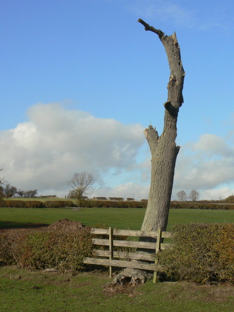
Decayed ash tree near Lings Lane
Pointing a ragged finger to the sky.
 Map © Crown Copyright")
TIP: Click the map for more Large scale mapping
- Grid Square
- SK6129, 35 images (more nearby 🔍)
- Photographer
- Alan Murray-Rust (more nearby)
- Date Taken
- Tuesday, 1 November, 2011 (more nearby)
- Submitted
- Tuesday, 8 November, 2011
- Subject Location
-
OSGB36:
 SK 6127 2970 [10m precision]
WGS84: 52:51.6785N 1:5.4840W - Camera Location
-
OSGB36: SK 6130 2968
- View Direction
- Northwest (about 315 degrees)