2011
NT4227 : The Upper Loch at Bowhill
taken 12 years ago, near to Philiphaugh, Scottish Borders, Scotland
This is 1 of 2 images, with title The Upper Loch at Bowhill in this square
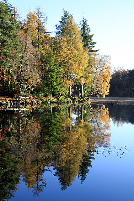
The Upper Loch at Bowhill
The Upper Loch at the Bowhill Estate near Selkirk was formed in 1816 during landscape gardening works. It is a pleasant place to walk around, especially on a fine day in November with the autumn tints on show.
 Map © Crown Copyright")
TIP: Click the map for more Large scale mapping
- Grid Square
- NT4227, 125 images (more nearby 🔍)
- Photographer
- Walter Baxter (more nearby)
- Date Taken
- Monday, 7 November, 2011 (more nearby)
- Submitted
- Thursday, 10 November, 2011
- Subject Location
-
OSGB36:
 NT 4275 2773 [10m precision]
WGS84: 55:32.3947N 2:54.5243W - Camera Location
-
OSGB36: NT 4270 2773
- View Direction
- EAST (about 90 degrees)