2011
NY2309 : Old adit, Grains Gill
taken 12 years ago, near to Seathwaite, Cumbria, England
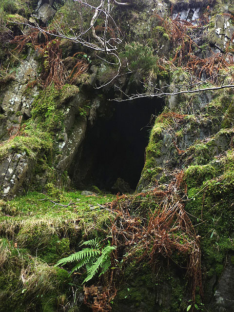
Old adit, Grains Gill
This short adit (mine level) runs for about 10m, curving to intersect a prominent white vein which can be seen in the bed of the gill just south. I inspected it with a headtorch and there were shot holes visible at the end but no signs of any metallic minerals. It may be connected with the ruin just above Link
 Map © Crown Copyright")
TIP: Click the map for more Large scale mapping
- Grid Square
- NY2309, 45 images (more nearby 🔍)
- Photographer
- Karl and Ali (more nearby)
- Date Taken
- Sunday, 13 November, 2011 (more nearby)
- Submitted
- Tuesday, 15 November, 2011
- Subject Location
-
OSGB36:
 NY 2354 0989 [10m precision]
WGS84: 54:28.7148N 3:10.8915W - Camera Location
-
OSGB36: NY 2354 0989
- View Direction
- EAST (about 90 degrees)