2011
NS2982 : Hermitage Park
taken 12 years ago, near to Helensburgh, Argyll And Bute, Scotland
This is 1 of 8 images, with title Hermitage Park in this square
Hermitage Park
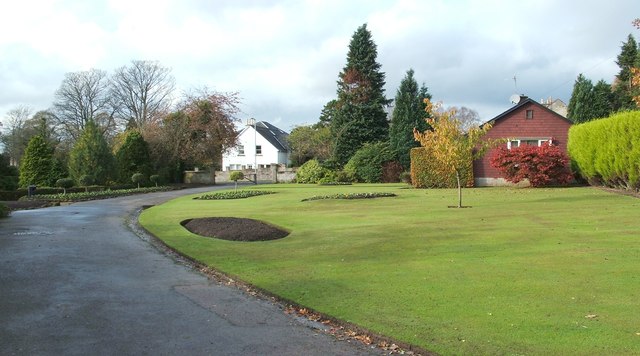
This is a view from within the park, looking towards its western entrance. That entrance is on Sinclair Street; the white house that is visible left of centre faces the park entrance across that street.
See also NS2982 : Hermitage Park.
See also NS2982 : Hermitage Park.
Hermitage Park, Helensburgh
This area was formerly the estate of Hermitage House; the house itself was demolished in 1963. The estate's walled garden still exists, and contains the town's war memorial ( Link ). The ruins of Malig Mill (the mill pre-dates the town of Helensburgh itself) are also located within the park, on the course of the Milligs Burn: Link
 Map © Crown Copyright")
TIP: Click the map for more Large scale mapping
- Grid Square
- NS2982, 538 images (more nearby 🔍)
- Photographer
- Lairich Rig (more nearby)
- Date Taken
- Wednesday, 26 October, 2011 (more nearby)
- Submitted
- Monday, 21 November, 2011
- Subject Location
-
OSGB36:
 NS 2981 8278 [10m precision]
WGS84: 56:0.4594N 4:43.8742W - Camera Location
-
OSGB36: NS 2985 8278
- View Direction
- WEST (about 270 degrees)