2011
SN7974 : Graig Goch and the Afon Ystwyth
taken 13 years ago, near to Cwmystwyth, Ceredigion/Sir Ceredigion, Wales
This is 1 of 2 images, with title Graig Goch and the Afon Ystwyth in this square
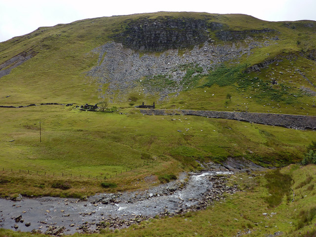
Graig Goch and the Afon Ystwyth
The ruins below the hill are the remains of the South Cwmystwyth mine (or Ystwyth South). The main Cwmystwyth Lead Mine complex is a short distance to the north east, on the opposite side of the valley.
 Map © Crown Copyright")
TIP: Click the map for more Large scale mapping
- Grid Square
- SN7974, 50 images (more nearby 🔍)
- Photographer
- Phil Champion (more nearby)
- Date Taken
- Saturday, 16 July, 2011 (more nearby)
- Submitted
- Saturday, 10 December, 2011
- Subject Location
-
OSGB36:
 SN 7994 7412 [10m precision]
WGS84: 52:21.1176N 3:45.8494W - Camera Location
-
OSGB36: SN 79800 74198
- View Direction
- East-southeast (about 112 degrees)