TQ3877 : Old drinking fountain in St Alfege Park
taken 12 years ago, near to Isle of Dogs, Tower Hamlets, England
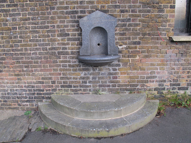
St Alfege Park was originally two orchards and the old churchyard. The orchards were given to the church in 1802 to be used as a new burial ground. That burial ground is long since closed and the park is now under the management of Greenwich Council.
The Metropolitan Drinking Fountain and Cattle Trough Association was founded in 1859 initially to provide clean drinking water in public places for people in London, but soon extended to include animals and also outside London itself. It is still active (now known as The Drinking Fountain Association), with the objectives of:
The promotion of the provision of drinking water for people and animals in the United Kingdom and Overseas
The preservation of the Association's archive materials, artefacts, drinking fountains, cattle troughs and other installations.
For full details of its history, see Link.
 Map © Crown Copyright")
- Grid Square
- TQ3877, 2289 images (more nearby 🔍)
- Photographer
- Stephen Craven (more nearby)
- Date Taken
- Saturday, 10 December, 2011 (more nearby)
- Submitted
- Monday, 12 December, 2011
- Subject Location
-
OSGB36:
 TQ 3823 7761 [10m precision]
WGS84: 51:28.8338N 0:0.6472W - Camera Location
-
OSGB36: TQ 3823 7761
- View Direction
- East-northeast (about 67 degrees)