2011
SJ8293 : Footpath off Nell Lane
taken 12 years ago, near to Withington, Manchester, England
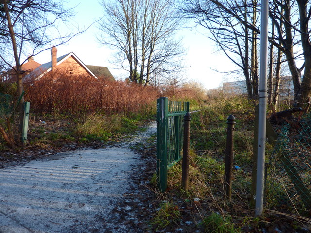
Footpath off Nell Lane
From Nell Lane a path follows Chorlton Brook along 'the Clough' towards Mauldeth Road West. The buildings of Chorlton High School, on the other side of the brook, can just be made out in the distance.
 Map © Crown Copyright")
TIP: Click the map for more Large scale mapping
- Grid Square
- SJ8293, 149 images (more nearby 🔍)
- Photographer
- Phil Champion (more nearby)
- Date Taken
- Sunday, 18 December, 2011 (more nearby)
- Submitted
- Sunday, 18 December, 2011
- Subject Location
-
OSGB36:
 SJ 8235 9335 [10m precision]
WGS84: 53:26.1978N 2:16.0288W - Camera Location
-
OSGB36: SJ 8234 9335
- View Direction
- East-northeast (about 67 degrees)