2006
ST7693 : St Mary the Virgin, Wotton-under-Edge
taken 17 years ago, near to Wotton-Under-Edge, Gloucestershire, England
This is 1 of 5 images, with title St Mary the Virgin, Wotton-under-Edge in this square
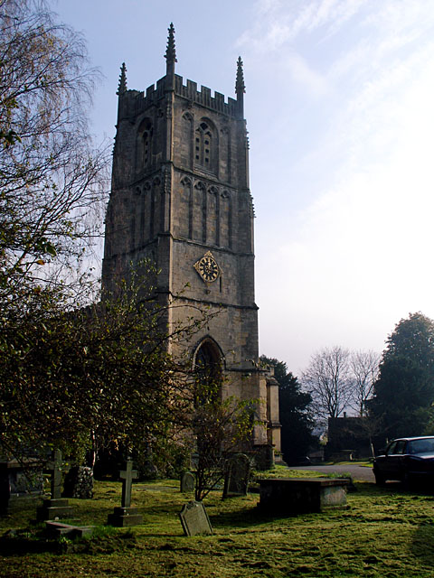
St Mary the Virgin, Wotton-under-Edge
The church is literally just on one side of the grid line, and the foreground is in ST7593. The tower dates from the late 14th century.
 Map © Crown Copyright")
TIP: Click the map for more Large scale mapping
- Grid Square
- ST7693, 110 images (more nearby 🔍)
- Photographer
- Linda Bailey (more nearby)
- Date Taken
- Sunday, 5 November, 2006 (more nearby)
- Submitted
- Tuesday, 7 November, 2006
- Subject Location
-
OSGB36:
 ST 7600 9341 [10m precision]
WGS84: 51:38.3386N 2:20.8921W - Camera Location
-
OSGB36: ST 7596 9345
- View Direction
- Southeast (about 135 degrees)