2011
TA0684 : Knipe Point, (or Osgodby Point)
taken 12 years ago, near to Osgodby, North Yorkshire, England
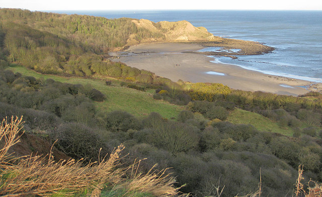
Knipe Point, (or Osgodby Point)
View from the top of Tenants' Cliff across Cayton Sands in a howling gale. The old A165, Bridlington to Scarborough road, now closed, gets ever closer to the edge at this point.
 Map © Crown Copyright")
TIP: Click the map for more Large scale mapping
- Grid Square
- TA0684, 161 images (more nearby 🔍)
- Photographer
- Pauline E (more nearby)
- Date Taken
- Wednesday, 28 December, 2011 (more nearby)
- Submitted
- Saturday, 31 December, 2011
- Subject Location
-
OSGB36:
 TA 064 849 [100m precision]
WGS84: 54:14.9562N 0:22.1013W - Camera Location
-
OSGB36: TA 063 845
- View Direction
- NORTH (about 0 degrees)