2011
ST0888 : Treforest Weir
taken 12 years ago, near to Treforest, Rhondda Cynon Taf, Wales
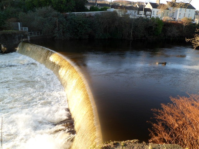
Treforest Weir
Looking west from first floor steps on a Cardiff Road (A4054) building.
The River Taff tumbles noisily down the weir, located 100 metres south of Castle Bridge. Link
The River Taff tumbles noisily down the weir, located 100 metres south of Castle Bridge. Link
 Map © Crown Copyright")
TIP: Click the map for more Large scale mapping
- Grid Square
- ST0888, 112 images (more nearby 🔍)
- Photographer
- Jaggery (more nearby)
- Date Taken
- Friday, 9 December, 2011 (more nearby)
- Submitted
- Friday, 6 January, 2012
- Subject Location
-
OSGB36:
 ST 084 889 [100m precision]
WGS84: 51:35.4886N 3:19.4205W - Camera Location
-
OSGB36: ST 084 889
- View Direction
- WEST (about 270 degrees)