2011
NR9836 : The String Road
taken 13 years ago, 3 km from Brodick, Isle of Arran, North Ayrshire, Scotland
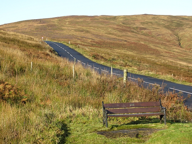
The String Road
A bench gives a fine view down Glen Shurig. The String is a pass which gives quick access to the west coast. On this occasion it was even more useful as I was travelling from Pirnmill to Lochranza - why the detour? A week long road closure at Catecol.
 Map © Crown Copyright")
TIP: Click the map for more Large scale mapping
- Grid Square
- NR9836, 10 images (more nearby 🔍)
- Photographer
- Richard Webb (more nearby)
- Date Taken
- Wednesday, 19 October, 2011 (more nearby)
- Submitted
- Sunday, 8 January, 2012
- Subject Location
-
OSGB36:
 NR 9826 3601 [10m precision]
WGS84: 55:34.5514N 5:12.1075W - Camera Location
-
OSGB36: NR 9830 3600
- View Direction
- West-northwest (about 292 degrees)