2012
TQ3783 : Railway lines to Liverpool Street outside Pudding Mill Lane station, viewed from Marshgate Lane
taken 12 years ago, near to Bow, Tower Hamlets, England
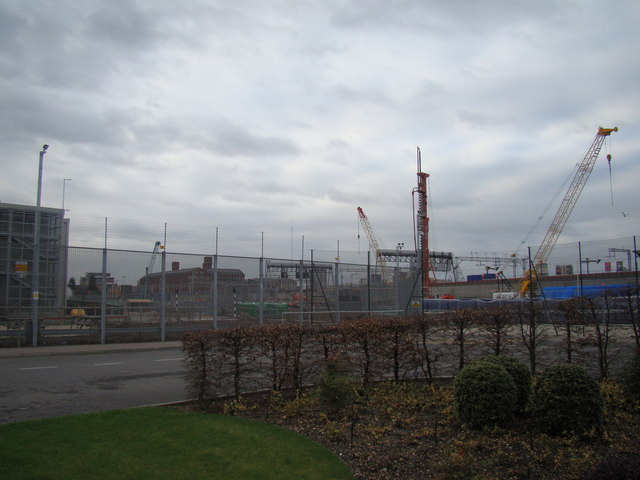
Railway lines to Liverpool Street outside Pudding Mill Lane station, viewed from Marshgate Lane
Looking north-northeast. The large brick building in the background is the former Bryant & May match factory on Wick Lane, adjacent to the A102(M) Blackwall Tunnel Approach, now part of the Bow Quarter Estate.
 Map © Crown Copyright")
TIP: Click the map for more Large scale mapping
- Grid Square
- TQ3783, 501 images (more nearby 🔍)
- Photographer
- Robert Lamb (more nearby)
- Date Taken
- Sunday, 8 January, 2012 (more nearby)
- Submitted
- Sunday, 8 January, 2012
- Subject Location
-
OSGB36:
 TQ 3742 8327 [10m precision]
WGS84: 51:31.8973N 0:1.2144W - Camera Location
-
OSGB36: TQ 3790 8354
- View Direction
- West-southwest (about 247 degrees)