2012
NS9159 : Blocked Access
taken 12 years ago, near to Fauldhouse, West Lothian, Scotland
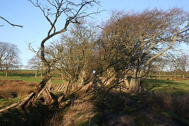
Blocked Access
I could not make up my mind whether this tree was blown down in the recent storms, or whether the road leading to Leadloch Farm has not been used for some time.
 Map © Crown Copyright")
TIP: Click the map for more Large scale mapping
- Grid Square
- NS9159, 17 images (more nearby 🔍)
- Photographer
- Anne Burgess (more nearby)
- Date Taken
- Monday, 9 January, 2012 (more nearby)
- Submitted
- Monday, 9 January, 2012
- Subject Location
-
OSGB36:
 NS 9177 5968 [10m precision]
WGS84: 55:49.0923N 3:43.7320W - Camera Location
-
OSGB36: NS 9179 5964
- View Direction
- North-northwest (about 337 degrees)