2012
SS9189 : Trig point on Pen y Foel
taken 12 years ago, near to Ogmore Vale, Bridgend/Pen-y-Bont ar Ogwr, Wales
This is 1 of 2 images, with title Trig point on Pen y Foel in this square
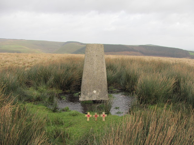
Trig point on Pen y Foel
There was no further information on the small memorial. Ogmore Forest is in the distance.
 Map © Crown Copyright")
TIP: Click the map for more Large scale mapping
- Grid Square
- SS9189, 6 images (more nearby 🔍)
- Photographer
- John Light (more nearby)
- Date Taken
- Thursday, 5 January, 2012 (more nearby)
- Submitted
- Wednesday, 11 January, 2012
- Subject Location
-
OSGB36:
 SS 918 895 [100m precision]
WGS84: 51:35.6687N 3:33.7357W - Camera Location
-
OSGB36: SS 918 895
- View Direction
- East-northeast (about 67 degrees)