2012
TQ9071 : The railway to Rushenden Pier
taken 12 years ago, near to Queenborough, Kent, England
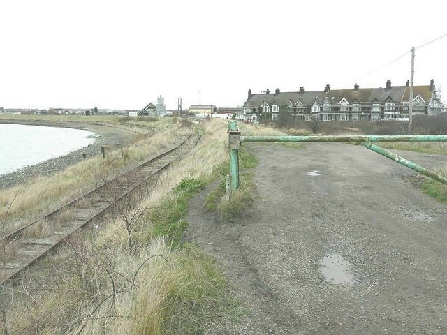
The railway to Rushenden Pier
Running past the terrace of houses in Alsager Avenue and beside Loading Hope Reach. It looked very doubtful that the railway was in use as the track was very buckled ahead.
 Map © Crown Copyright")
TIP: Click the map for more Large scale mapping
- Grid Square
- TQ9071, 61 images (more nearby 🔍)
- Photographer
- John Baker (more nearby)
- Date Taken
- Sunday, 8 January, 2012 (more nearby)
- Submitted
- Wednesday, 11 January, 2012
- Subject Location
-
OSGB36:
 TQ 9067 7153 [10m precision]
WGS84: 51:24.6437N 0:44.4187E - Camera Location
-
OSGB36: TQ 9063 7150
- View Direction
- East-northeast (about 67 degrees)