2012
SD9889 : Where did that bridge go?
taken 12 years ago, near to Woodhall, North Yorkshire, England
Where did that bridge go?
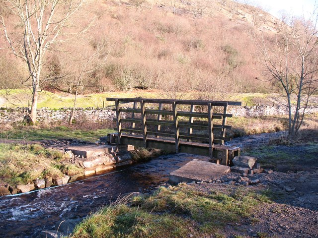
The splendid drystone single arch footbridge that was constructed here in August 2010 is no more [see 'Ballowfield drystone bridge' by Anthony Harrison and 'New bridge at Ballowfield']. In December 2011 a rapid thaw of lying snow together with very heavy rain caused localised flooding in the Dales. Eller Beck became a raging torrent and severely damaged the new footbridge, so the remains have been taken away and this simple timber beam bridge put in its place. There are plans for a stone arch bridge Mk2 later in 2012.
 Map © Crown Copyright")
TIP: Click the map for more Large scale mapping
- Grid Square
- SD9889, 52 images (more nearby 🔍)
- Photographer
- Gordon Hatton (more nearby)
- Date Taken
- Friday, 13 January, 2012 (more nearby)
- Submitted
- Friday, 13 January, 2012
- Subject Location
-
OSGB36:
 SD 9857 8989 [10m precision]
WGS84: 54:18.2768N 2:1.4087W - Camera Location
-
OSGB36: SD 9856 8989
- View Direction
- East-northeast (about 67 degrees)