2012
SE2733 : Ordnance Survey Cut Mark on wall of 2 Salisbury Avenue, Armley
taken 12 years ago, near to Headingley, Leeds, England
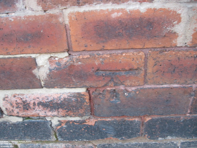
Ordnance Survey Cut Mark on wall of 2 Salisbury Avenue, Armley
Can be found on the house wall end.
 Map © Crown Copyright")
TIP: Click the map for more Large scale mapping
- Grid Square
- SE2733, 763 images (more nearby 🔍)
- Photographer
- Peter Wood (more nearby)
- Date Taken
- Saturday, 14 January, 2012 (more nearby)
- Submitted
- Saturday, 14 January, 2012
- Subject Location
-
OSGB36:
 SE 27256 33814 [1m precision]
WGS84: 53:47.9952N 1:35.2600W