2012
NZ1338 : Rough grazing west of Sunniside
taken 12 years ago, near to Sunniside, County Durham, England
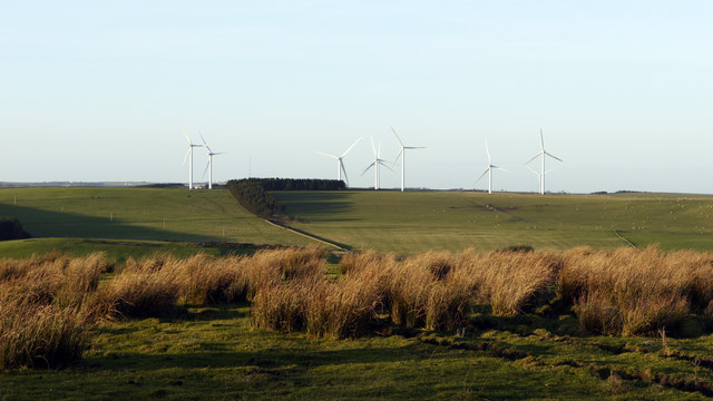
Rough grazing west of Sunniside
Beyond the rough pasture lies the valley of the River Deerness. Gladstone Terrace of the small village of Sunniside lies just to the right of the camera position.
 Map © Crown Copyright")
TIP: Click the map for more Large scale mapping
- Grid Square
- NZ1338, 8 images (more nearby 🔍)
- Photographer
- Trevor Littlewood (more nearby)
- Date Taken
- Friday, 13 January, 2012 (more nearby)
- Submitted
- Saturday, 14 January, 2012
- Subject Location
-
OSGB36:
 NZ 1385 3859 [10m precision]
WGS84: 54:44.5253N 1:47.1836W - Camera Location
-
OSGB36: NZ 1389 3854
- View Direction
- Northwest (about 315 degrees)