1981
NG7556 : Kenmore - 1981
taken 43 years ago, near to Kenmore, Highland, Scotland
Kenmore - 1981
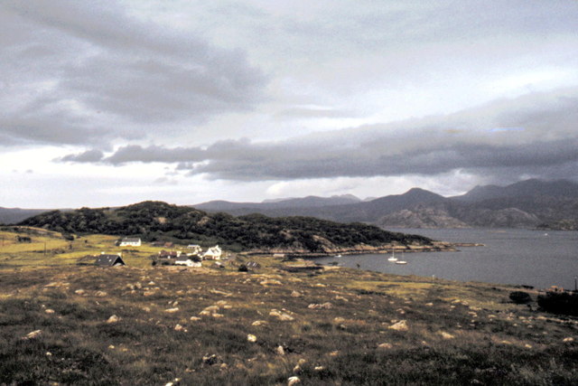
Kenmore, Loch a' Chracaich.
Loch Torridon is a sea loch on the west coast of Scotland in the Northwest Highlands. The loch was created by glacial processes and is in total around 25 km long.
It has two sections: Upper Loch Torridon to landward, east of Rubha na h-Airde Ghlaise, at which point it joins Loch Sheildaig; and the main western section of Loch Torridon proper.
Loch a' Chracaich and Loch Beag are small inlets on the southern shores of the outer Loch, which joins the Inner Sound between the headlands of Rubha na Fearna to the south and Red Point to the north.
The name Thoirbhearta has a similar root to Tarbert and indicates a place where boats were dragged overland.
 Map © Crown Copyright")
TIP: Click the map for more Large scale mapping
- Grid Square
- NG7556, 14 images (more nearby 🔍)
- Photographer
- Helmut Zozmann (more nearby)
- Date Taken
- August 1981 (more nearby)
- Submitted
- Sunday, 15 January, 2012
- Subject Location
-
OSGB36:
 NG 758 569 [100m precision]
WGS84: 57:32.8204N 5:44.8883W - Camera Location
-
OSGB36: NG 759 568
- View Direction
- North-northwest (about 337 degrees)