2011
SN6658 : Road junction and fields south-west of Tregaron, Ceredigion
taken 13 years ago, near to Tregaron, Ceredigion/Sir Ceredigion, Wales
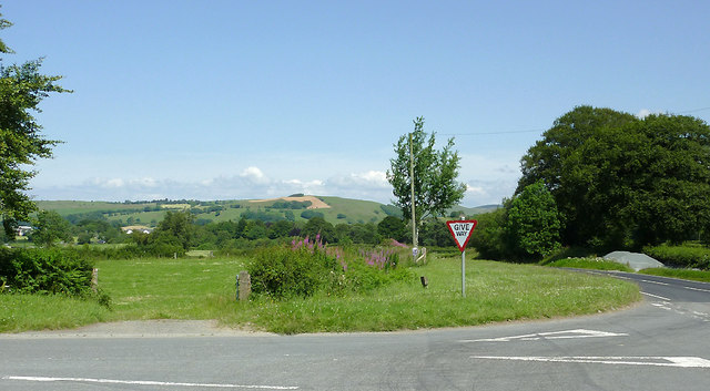
Road junction and fields south-west of Tregaron, Ceredigion
This is where the B4342 from New Quay and Llangeitho meets the A485 from Lampeter as it approaches Tregaron. Straight ahead is a rosebay willowherb colonised embankment to the right of which used to be a stone bridge over the former Manchester and Milford Railway (line finally closed in 1970). Link The track course continued to the right of the far gap in the hedge, and on to Tregaron and Cors Caron. The double bend in the road has been eliminated by the upgrading of the A485 and demolition of the bridge in the late 1990s(?).
 Map © Crown Copyright")
TIP: Click the map for more Large scale mapping
- Grid Square
- SN6658, 22 images (more nearby 🔍)
- Photographer
- Roger D Kidd (more nearby)
- Date Taken
- Thursday, 14 July, 2011 (more nearby)
- Submitted
- Sunday, 15 January, 2012
- Subject Location
-
OSGB36:
 SN 668 587 [100m precision]
WGS84: 52:12.6307N 3:57.0032W - Camera Location
-
OSGB36: SN 668 586
- View Direction
- Northeast (about 45 degrees)