2012
SJ7588 : Bridgewater Canal, Marina at Oldfield Brow
taken 12 years ago, near to Broadheath, Trafford, England
This is 1 of 18 images, with title starting with Bridgewater in this square
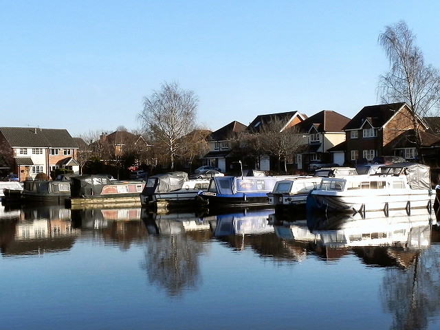
Bridgewater Canal, Marina at Oldfield Brow
Often considered to be the first "true" canal, the Bridgewater Canal was commissioned by Francis Egerton, 3rd Duke of Bridgewater, to transport coal from his mines in Worsley. The section from Worsley to Manchester opened on 17th July 1761; it was later extended from Manchester to Runcorn, and then from Worsley to Leigh. Coal was needed in large quantities to fuel the industrial revolution and the canal enabled coal and other goods to be transported efficiently and cheaply to the rapidly expanding towns and cities. Its success helped inspire a period of intense canal building although it later faced intense competition from the Liverpool and Manchester Railway and the Macclesfield Canal.
The canal is connected to the Rochdale Canal (Link ) in Manchester, the Trent and Mersey Canal at Preston Brook, south-east of Runcorn, and to the Leeds and Liverpool Canal at Leigh. It once connected with the River Mersey at Runcorn but has since been cut off by a slip road to the Silver Jubilee Bridge.
Navigable throughout its history, it is one of the few canals in Britain not to have been nationalised, and remains privately owned. Commercial traffic continued on the canal until 1974. By this time, canals were becoming more important as a leisure facility and pleasure craft now use the canal which forms part of the Cheshire Ring circular canal route.
For many years, the canal around Worsley was noted for the distinctive bright orange colouring of the water. This was a result of iron oxide from the mines tainting the water as the canal passes through Worsley. A £2.5 million remedial scheme was undertaken in 2013 to remove this colouration.
The Bridgewater Canal is owned and operated by the Manchester Ship Canal Company in conjunction with the Bridgewater Canal Trust.
Link Bridgewater Canal Company
Link Pennine Waterways
Link Wikipedia
See other images of The Bridgewater Canal
The canal is connected to the Rochdale Canal (Link ) in Manchester, the Trent and Mersey Canal at Preston Brook, south-east of Runcorn, and to the Leeds and Liverpool Canal at Leigh. It once connected with the River Mersey at Runcorn but has since been cut off by a slip road to the Silver Jubilee Bridge.
Navigable throughout its history, it is one of the few canals in Britain not to have been nationalised, and remains privately owned. Commercial traffic continued on the canal until 1974. By this time, canals were becoming more important as a leisure facility and pleasure craft now use the canal which forms part of the Cheshire Ring circular canal route.
For many years, the canal around Worsley was noted for the distinctive bright orange colouring of the water. This was a result of iron oxide from the mines tainting the water as the canal passes through Worsley. A £2.5 million remedial scheme was undertaken in 2013 to remove this colouration.
The Bridgewater Canal is owned and operated by the Manchester Ship Canal Company in conjunction with the Bridgewater Canal Trust.
Link
Link
Link
See other images of The Bridgewater Canal
 Map © Crown Copyright")
TIP: Click the map for more Large scale mapping
- Grid Square
- SJ7588, 44 images (more nearby 🔍)
- Photographer
- David Dixon (more nearby)
- Date Taken
- Saturday, 14 January, 2012 (more nearby)
- Submitted
- Monday, 16 January, 2012
- Subject Location
-
OSGB36:
 SJ 7569 8871 [10m precision]
WGS84: 53:23.6794N 2:22.0222W - Camera Location
-
OSGB36: SJ 7564 8872
- View Direction
- East-southeast (about 112 degrees)