2012
NY9301 : Blakethwaite Smelt Mill
taken 12 years ago, 4 km N of Ivelet, North Yorkshire, England
This is 1 of 9 images, with title Blakethwaite Smelt Mill in this square
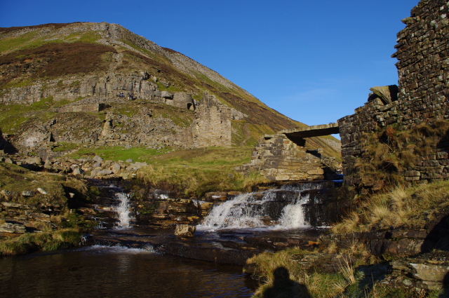
Blakethwaite Smelt Mill
The confluence of Gunnerside Beck (with the slab bridge) and Blind Gill. The ruins of the smelt mill are in the centre, with a lime kiln beyond. The route of the smelt mill flue runs up the fellside on the left.
 Map © Crown Copyright")
TIP: Click the map for more Large scale mapping
- Grid Square
- NY9301, 68 images (more nearby 🔍)
- Photographer
- Ian Taylor (more nearby)
- Date Taken
- Saturday, 14 January, 2012 (more nearby)
- Submitted
- Monday, 16 January, 2012
- Subject Location
-
OSGB36:
 NY 9369 0176 [10m precision]
WGS84: 54:24.6751N 2:5.9237W - Camera Location
-
OSGB36: NY 9369 0176
- View Direction
- NORTH (about 0 degrees)