2012
NT2266 : Fence and dyke on Allermuir Hill
taken 12 years ago, near to Colinton, Edinburgh, Scotland
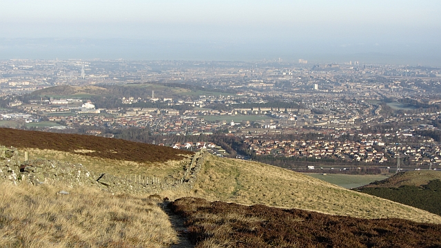
Fence and dyke on Allermuir Hill
One of the fences that meet at the summit of Allermuir heads northwards towards Edinburgh.
 Map © Crown Copyright")
TIP: Click the map for more Large scale mapping
- Grid Square
- NT2266, 120 images (more nearby 🔍)
- Photographer
- Richard Webb (more nearby)
- Date Taken
- Monday, 16 January, 2012 (more nearby)
- Submitted
- Monday, 16 January, 2012
- Subject Location
-
OSGB36:
 NT 2276 6663 [10m precision]
WGS84: 55:53.1955N 3:14.1851W - Camera Location
-
OSGB36: NT 2275 6658
- View Direction
- North-northeast (about 22 degrees)