2012
NY8240 : Highwatch Currick: trig point, cairn and wall
taken 12 years ago, 3 km from Lanehead, County Durham, England
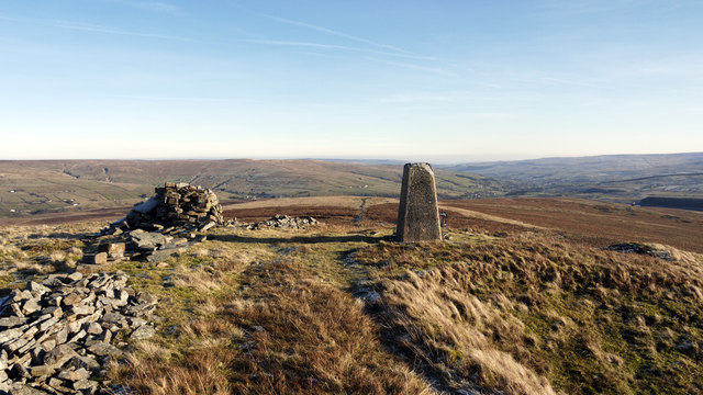
Highwatch Currick: trig point, cairn and wall
Highwatch Currick occupies a location on the long east ridge of Dead Stones, which projects into Weardale. The term currick refers presumably to the cairn.
Weardale is the valley extending away from the right side of the pillar.
Weardale is the valley extending away from the right side of the pillar.
 Map © Crown Copyright")
TIP: Click the map for more Large scale mapping
- Grid Square
- NY8240, 21 images (more nearby 🔍)
- Photographer
- Trevor Littlewood (more nearby)
- Date Taken
- Monday, 16 January, 2012 (more nearby)
- Submitted
- Monday, 16 January, 2012
- Subject Location
-
OSGB36:
 NY 8210 4002 [10m precision]
WGS84: 54:45.2882N 2:16.7787W - Camera Location
-
OSGB36: NY 8206 4002
- View Direction
- EAST (about 90 degrees)