TQ7253 : Medway Valley Walk approaching Barming Bridge
taken 13 years ago, near to Barming, Kent, England
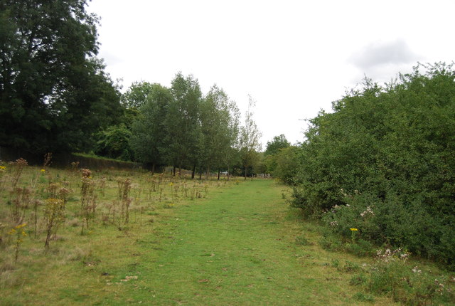
Maidstone Millennium River Park is situated along the banks of the River Medway between Teston and Allington. The park is unique in its rural character at both ends and its urban ambience as it passes through the Town Centre.
This River Park is one of the lasting legacy projects funded in part by the National Lottery to celebrate the new millennium.
It is a walk 10km along the River Medway from Teston Country Park, which includes a picnic area, to Allington where there is the Museum of Kent Life and Cobtree Manor Park and Golf Course.
Along the route are three nationally-acclaimed pedestrian bridges, riverbank and footpath improvements, more than 1500 new trees and in Maidstone an amphitheatre.
The River Park was started in 1998 and completed in 2001.
The Medway Valley Walk is a 28 mile walk in West Kent, with interesting landscape, natural history and archaeology. It passes through a varied landscape of downland, woodland, orchards, hop gardens, meadows and farmland, lakes and marshland, unspoilt villages and historic towns. The walk starts in Tonbridge and ends in Rochester. Links are made with the Greensand Way, North Downs Way, Saxon Shore Way and Wealdway.
The start of the walk is linked by the waymarked Eden Valley Walk (15 miles) to the Vanguard Way at Haxted. The Len Valley Walk (12 miles) connects with the Medway Valley Walk at Maidstone and following the course of the River Len also connects with the Stour Valley Walk (Kent) at Lenham, thus creating a waymarked 80 mile route between Tonbridge and the sea at Sandwich.
 Map © Crown Copyright")
- Grid Square
- TQ7253, 87 images (more nearby 🔍)
- Photographer
- N Chadwick (more nearby)
- Date Taken
- Tuesday, 30 August, 2011 (more nearby)
- Submitted
- Tuesday, 17 January, 2012
- Subject Location
-
OSGB36:
 TQ 7233 5393 [10m precision]
WGS84: 51:15.5092N 0:28.1018E - Camera Location
-
OSGB36: TQ 7231 5393
- View Direction
- EAST (about 90 degrees)