2012
TQ2890 : Muswell Avenue
taken 12 years ago, near to Friern Barnet, Barnet, England
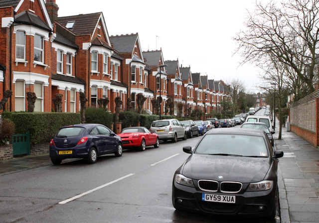
Muswell Avenue
This street appears on the map circa 1895. The terraced houses marching up the left hand side of the road had been completed by 1912 and presumably date to around the turn of the century.
 Map © Crown Copyright")
TIP: Click the map for more Large scale mapping
- Grid Square
- TQ2890, 152 images (more nearby 🔍)
- Photographer
- Martin Addison (more nearby)
- Date Taken
- Friday, 20 January, 2012 (more nearby)
- Submitted
- Monday, 23 January, 2012
- Subject Location
-
OSGB36:
 TQ 2869 9017 [10m precision]
WGS84: 51:35.7411N 0:8.6100W - Camera Location
-
OSGB36: TQ 2867 9022
- View Direction
- South-southeast (about 157 degrees)