2012
SY5198 : The Track to Loscombe
taken 12 years ago, near to Poorton, Dorset, England
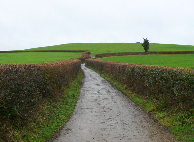
The Track to Loscombe
This track leads south west from Manor Farm towards the unamde hill with trig point marked but then heads north and contours round the hill before descending to Loscombe.
 Map © Crown Copyright")
TIP: Click the map for more Large scale mapping
- Grid Square
- SY5198, 88 images (more nearby 🔍)
- Photographer
- Nigel Mykura (more nearby)
- Date Taken
- Tuesday, 24 January, 2012 (more nearby)
- Submitted
- Wednesday, 25 January, 2012
- Subject Location
-
OSGB36:
 SY 5175 9821 [10m precision]
WGS84: 50:46.8868N 2:41.1456W - Camera Location
-
OSGB36: SY 5183 9826
- View Direction
- Southwest (about 225 degrees)