2010
SN7851 : Moorland and forest south-east of Soar-y-Mynydd, Ceredigion
taken 14 years ago, 4 km N of Ystradffin, Carmarthenshire/Sir Gaerfyrddin, Wales
This is 1 of 4 images, with title Moorland and forest south-east of Soar-y-Mynydd, Ceredigion in this square
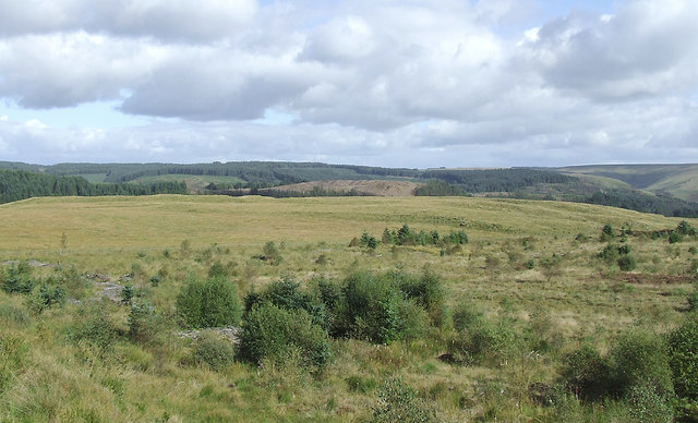
Moorland and forest south-east of Soar-y-Mynydd, Ceredigion
Cwm Camddwr, with its branch of Llyn Brianne, is hidden between the mid-ground moorland and the far Tywi Forest. The foreground is clear felled forestry land. Before the plantations began in the 1960s, the whole Elenydd area was remote moorland. Early settlements in the valleys were mainly abandoned during the early-mid 20th century.
 Map © Crown Copyright")
TIP: Click the map for more Large scale mapping
- Grid Square
- SN7851, 26 images (more nearby 🔍)
- Photographer
- Roger D Kidd (more nearby)
- Date Taken
- Friday, 17 September, 2010 (more nearby)
- Submitted
- Thursday, 26 January, 2012
- Subject Location
-
OSGB36:
 SN 789 510 [100m precision]
WGS84: 52:8.6423N 3:46.1895W - Camera Location
-
OSGB36: SN 788 510
- View Direction
- East-southeast (about 112 degrees)