2012
TQ4110 : River Ouse, view from Phoenix Causeway
taken 12 years ago, near to Lewes, East Sussex, England
This is 1 of 38 images, with title starting with River Ouse in this square
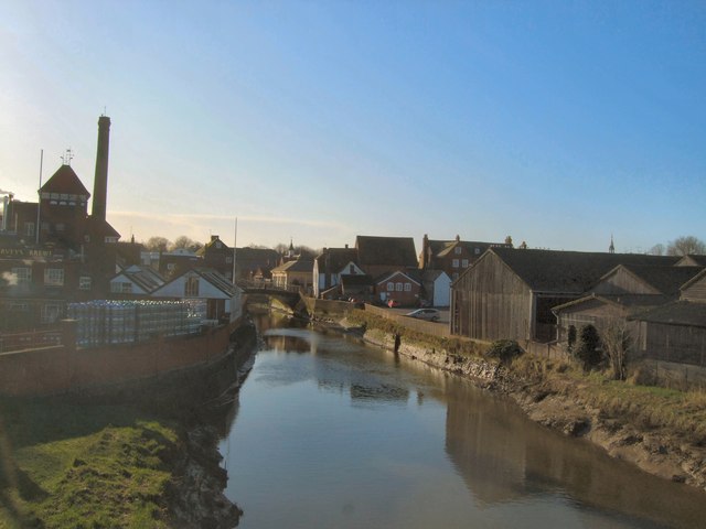
River Ouse, view from Phoenix Causeway
Looking south with Harveys Brewery to the right
River Ouse (Sussex)
The Ouse rises at Lower Beeding and flows generally southwards to reach the English Channel at Newhaven, a distance of approximately 33 miles. The Sussex Ouse Valley Way follows its route from source to mouth. The River is one of four rivers to cut through the South Downs, an example of Superimposed drainage.
Wikipedia: Link
 Map © Crown Copyright")
TIP: Click the map for more Large scale mapping
- Grid Square
- TQ4110, 1148 images (more nearby 🔍)
- Photographer
- Paul Gillett (more nearby)
- Date Taken
- Friday, 27 January, 2012 (more nearby)
- Submitted
- Friday, 27 January, 2012
- Subject Location
-
OSGB36:
 TQ 41938 10321 [1m precision]
WGS84: 50:52.4979N 0:0.9614E - Camera Location
-
OSGB36: TQ 41956 10369
- View Direction
- South-southwest (about 202 degrees)