2011
NC2127 : Allt na Bradhan, Quinag
taken 13 years ago, 4 km SSW of Newton, Highland, Scotland
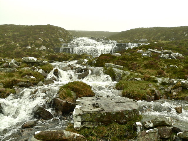
Allt na Bradhan, Quinag
Downstream from NC2128 : Lochan Bealach Cornaidh outflow the burn drops over a series of well-defined horizontal strata.
 Map © Crown Copyright")
TIP: Click the map for more Large scale mapping
- Grid Square
- NC2127, 18 images (more nearby 🔍)
- Photographer
- AlastairG (more nearby)
- Date Taken
- Thursday, 2 June, 2011 (more nearby)
- Submitted
- Friday, 27 January, 2012
- Subject Location
-
OSGB36:
 NC 2120 2795 [10m precision]
WGS84: 58:12.2383N 5:2.6680W - Camera Location
-
OSGB36: NC 2121 2794
- View Direction
- North-northwest (about 337 degrees)