2012
NT8438 : Still Waters Run Deep?
taken 12 years ago, near to Coldstream, Scottish Borders, Scotland
Still Waters Run Deep?
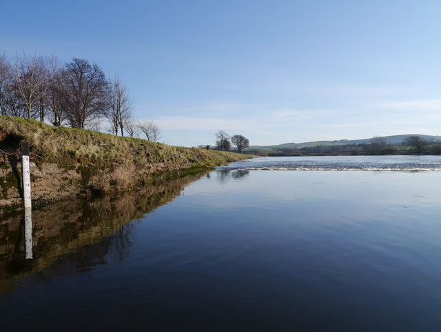
A water level marker in the River Tweed near the Lees fishing lodge. In the middle distance, the Lees Weir can be noted.
 Map © Crown Copyright")
TIP: Click the map for more Large scale mapping
- Grid Square
- NT8438, 34 images (more nearby 🔍)
- Photographer
- James T M Towill (more nearby)
- Date Taken
- Saturday, 28 January, 2012 (more nearby)
- Submitted
- Saturday, 28 January, 2012
- Subject Location
-
OSGB36:
 NT 8436 3887 [10m precision]
WGS84: 55:38.5874N 2:15.0024W - Camera Location
-
OSGB36: NT 8434 3888
- View Direction
- East-southeast (about 112 degrees)