2012
SO0601 : Nant Cwm Du, Troedyrhiw
taken 12 years ago, near to Troedyrhiw, Merthyr Tydfil/Merthyr Tudful, Wales
Nant Cwm Du, Troedyrhiw
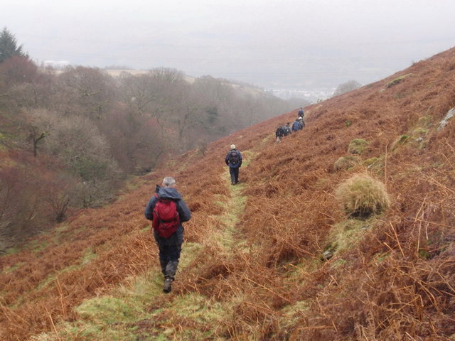
Cerddwyr yn dilyn llwybr uwchben Nant Cwm Du ar lethrau is Mynydd Merthyr. Yr anheddiad yn y pellter yng Nghwm Taf yw Troedyrhiw.
Walkers descending the lower slopes of Mynydd Merthyr above Cwm Nant Du (trans. Black Valley) stream. The settlement in the distance is Troedyrhiw (trans. foot of the hill) in the Taff Vale.
Walkers descending the lower slopes of Mynydd Merthyr above Cwm Nant Du (trans. Black Valley) stream. The settlement in the distance is Troedyrhiw (trans. foot of the hill) in the Taff Vale.
 Map © Crown Copyright")
TIP: Click the map for more Large scale mapping
- Grid Square
- SO0601, 19 images (more nearby 🔍)
- Photographer
- Alan Richards (more nearby)
- Date Taken
- Sunday, 29 January, 2012 (more nearby)
- Submitted
- Monday, 30 January, 2012
- Subject Location
-
OSGB36:
 SO 0623 0188 [10m precision]
WGS84: 51:42.4676N 3:21.5085W - Camera Location
-
OSGB36: SO 0619 0184
- View Direction
- Northeast (about 45 degrees)